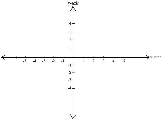
Cartesian coordinate system
In ARCHLine.XP you can use two coordinate systems and you can switch between them at any time:
- Absolute Coordinates, a fixed coordinate system (WCS): Cartesian (X, Y) coordinates relative to the fixed, absolute (WCS) origin. You can enter absolute X and Y values in the Coordinate Fields.
- Relative Coordinates, a relocatable user coordinate system (UCS): Cartesian (X, Y) coordinates relative to a specified origin. The relative origin can move as you work, relocating to last selected point.
No matter what kind of drawing you are working in ARCHLine.XP you have to specify points accurately. ARCHLine.XP uses two or threedimensional Cartesian or with other words rectangular coordinate system. It means you specify the distance from an established origin measured along X-axis, Y-axis and in 3D the Z-axis.
In addition to Cartesian coordinates you can work with Polar coordinates in ARCHLine.XP, but that is not the topic of this article. Conventionally, the x-axis is horizontal and the y-axis is vertical, with positive number signifying a move to the right, and a negative number signifying a move to the left.

Fixed coordinate system or WCS (World Coordinate System in other terminology)
The elements in project are stored in the a fixed coordinate system (WCS), when you start a new project fixed coordinate system and user coordinate system are identical. The fixed coordinate system does not allow to change the direction of the x-axis. The y-axis is always straight up, and you cannot rotate it.
User coordinate system
Many times, you can more easily create drawings using an additional coordinate system. This system called user coordinate system (UCS). It can be particularly useful when the building main wall direction is not horizontal or vertical but e.g. 25 degree to the other, because you can relocate and rotate UCS as well. The user coordinate system origin can be relocated to a new point any time.
You can specify the user- coordinate system origin by using the command: Drafting - Tools – New Origin – Relocate Origin. You can reset user- coordinate system and return to fixed coordinate system origin with the command: Drafting - Tools – New Origin – Reset Origin

Enter points or coordinates
There are three ways to enter points or coordinates:
- Using absolute coordinates
- Using relative coordinates
- Using distance entry
Absolute coordinate entry
Absolute coordinates means the default coordinate system or WCS (World Coordinate System in other terminology). Absolute coordinates are always measured from the origin point: 0, 0.
Relative coordinate entry
In ARCHLine.XP relative coordinates are always measured from the last input point in the drawing.
Distance entry
Distance entry means the next input value is defined by pointing in a particular direction with the cursor and entering the distance value in the input field. Press Enter to activate the input. Example: You draw a horizontal wall with 6000 mm length. Specify the first point of the wall then move the cursor to the right near to horizontal and type the following: 6000 mm and press Enter. If you type the unit after the value the software always converts it to the actual model unit.

How to toggle between relative and absolute coordinates?
In the status bar at the bottom of ARCHLine.XP, there is a button to display the current coordinate entry mode. Press the button to toggle between relative and absolute coordinates.
Comments
0 comments
Article is closed for comments.